Water Supply Outlook for Alberta
April 2006
Plains Snowpack |
|
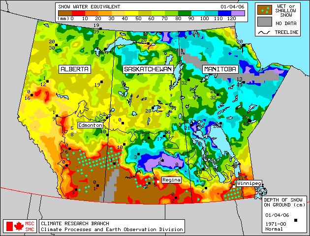
Sixty-six snow course measurements were taken in many plains areas of Alberta at the end of March (Figure 1). As of April 1, 2006, generally average to above average snowpack conditions existed in most of central Alberta, mainly due to an early March snow storm and cooler temperatures. West central areas along the foothills however had below average to average snowpack. Melt in central Alberta has been very active since measurements were taken. Generally, snowpack conditions are below average to average between Lesser Slave Lake and Edson, below average in the Grande Prairie area, and average in the High Level area. Snowpack in the Fort Chipewyan region varied widely from much below average to average. Satellite estimation of plains snowpack as of April 1, 2006 is available in Figure 2. The April 1 satellite map shows that the most of the plains snowpack in southern Alberta has melted. Weekly updates to the satellite map are available on the Meteorological Survey of Canada website . |
For technical enquires about this web page please contact Alberta Environment - Environmental Management Water Management Operations Branch at AENV-WebWS@gov.ab.ca