Water Supply Outlook for Alberta
March 2003
Plains Snowpack |
|
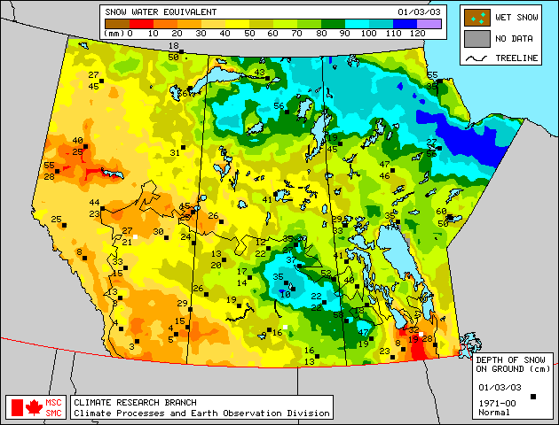
Seventy-one snow course measurements were taken in plains areas of Alberta at the end of February. Most snow measurements indicate above-normal to much-above-normal snowpack west of a line extending from the Peace River region to Slave Lake to Edmonton to Coronation (Figure 1). Snowpack along a narrow band east of this line is below-normal to normal. Moving toward the foothills from Grande Prairie and Edson, snowpacks taper to normal to below-normal. Snow course measurements indicate below-normal to much-below-normal snowpacks in the High Level, Fort Chipewyan, Cold Lake, and Cypress Hills areas. In the Fort McMurray area, snowpack is below-normal as of March 1. In southern Alberta, areas south of a line extending from Calgary to Medicine Hat have generally below-normal snowpack, while areas between this line and Coronation have generally near-normal snowpack. Satellite estimation of snow water equivalent and snow depth as of March 1, 2003 is available in Figure 2, courtesy of the Meteorological Service of Canada. |
For technical enquires about this web page please contact Alberta Environment - Environmental Management Water Management Operations Branch at AENV-WebWS@gov.ab.ca