Water Supply Outlook for Alberta
March 2005
Plains Snowpack |
|
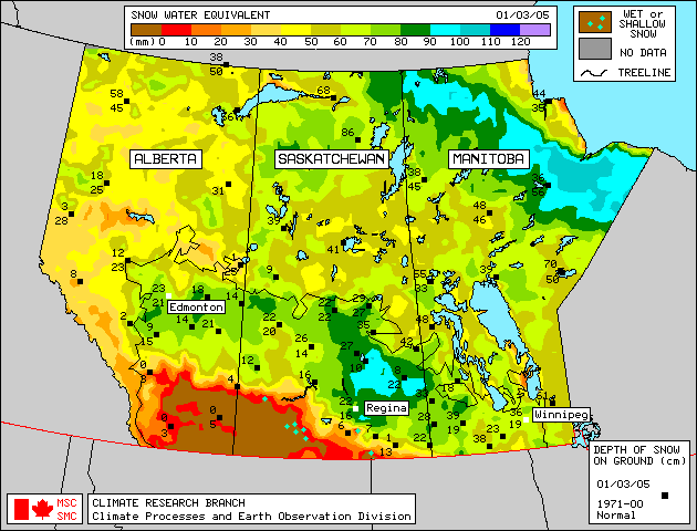
Seventy-one snow course measurements were taken in many plains areas of Alberta at the end of February (Figure 1). As of March 1, 2005, above average to much above average snowpack existed in a band across central Alberta between Edmonton and Red Deer, and also in the High Level and Fort Chipewyan regions. Below average to average snowpack was measured just south of Red Deer, near Cold Lake, and in a strip from Edson and Edmonton northwest to the Peace River region. Much below average snow accumulations were measured at the remaining snow course locations, including the Grande Prairie, Slave Lake, Athabasca, and Lloydminster areas. Satellite estimation of plains snowpack as of March 1, 2005 is available in Figure 2. In the Fort McMurray area, snowpack is estimated to be average to above average. In southern Alberta, little to no snow cover is left south of a line from Calgary to Empress. Weekly updates to the satellite map are available on the Meteorological Survey of Canada website . Significant melt has occurred during the first ten days of March, after these measurements were taken. These snow course locations will be surveyed again at the end of March and will be included in next month's Water Supply Outlook report. |
For technical enquires about this web page please contact Alberta Environment - Environmental Management Water Management Operations Branch at AENV-WebWS@gov.ab.ca