Water Supply Outlook for Alberta
March 2006
Plains Snowpack |
|
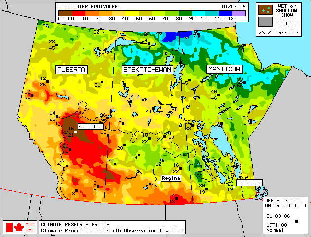
Seventy-one snow course measurements were taken in many plains areas of Alberta at the end of February (Figure 1). As of March 1, 2006, generally much below average snowpack conditions exist throughout central Alberta. The exceptions were three snow courses in the Rocky Mountain House area, where below average snowpacks were observed. Generally below to much below average snowpack conditions exist in the Smoky River basin and western Peace River basin, Fort Chipewyan and in the Cypress Hills. Satellite estimation of plains snowpack as of March 1, 2006 is available in Figure 2. Snowpack conditions were estimated to be near average in southern Alberta as of March 1, but this may be a bit high. Weekly updates to the satellite map are available on the Meteorological Survey of Canada website . A snow storm moved through central Alberta between February 27 and March 1, 2006 providing generally between 5 and 10 mm of snow water equivalent for the Edmonton-Red Deer- Lloydminister region. Some of the snow courses in this region may have been completed prior to or during this snowfall event. Analysis of the data shows that although the snow water equivalent may have increased, this region is still considered to have generally much below average snowpack conditions. |
For technical enquires about this web page please contact Alberta Environment - Environmental Management Water Management Operations Branch at AENV-WebWS@gov.ab.ca